Hoeyang County (Hoeyang-gun)
Hoeyang County is a kun, or county, in Kangwŏn province, North Korea. It was established in a general reorganization of local government in 1952.
The county's area is primarily mountainous, with the Taebaek and Kwangju ranges both passing through the county. Two basins, the Hoeyang Basin and Changdo Basin, interrupt the rugged terrain. The highest point is Piryubong on Kŭmgangsan. The chief local stream is the Pukhan River, which flows south and east into South Korea. The climate is continental, with extremely cold winters.
The county's area is primarily mountainous, with the Taebaek and Kwangju ranges both passing through the county. Two basins, the Hoeyang Basin and Changdo Basin, interrupt the rugged terrain. The highest point is Piryubong on Kŭmgangsan. The chief local stream is the Pukhan River, which flows south and east into South Korea. The climate is continental, with extremely cold winters.
Map - Hoeyang County (Hoeyang-gun)
Map


Country - North_Korea
 |
 |
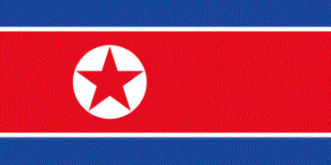
| Flag of North Korea | |
In 1910, Korea was annexed by the Empire of Japan. In 1945, after the Japanese surrender at the end of World War II, Korea was divided into two zones along the 38th parallel, with the north occupied by the Soviet Union and the south occupied by the United States. Negotiations on reunification failed, and in 1948, separate governments were formed: the socialist and Soviet-aligned Democratic People's Republic of Korea in the north, and the capitalist, Western-aligned Republic of Korea in the south. The Korean War began in 1950, with an invasion by North Korea, and lasted until 1953. The Korean Armistice Agreement brought about a ceasefire and established a demilitarized zone (DMZ), but no formal peace treaty has ever been signed.
Currency / Language
| ISO | Currency | Symbol | Significant figures |
|---|---|---|---|
| KPW | North Korean won | â‚© | 2 |
| ISO | Language |
|---|---|
| KO | Korean language |